Global positioning technologies are revolutionizing modern agriculture by enabling farmers to manage their fields with unprecedented accuracy and control. By leveraging satellite signals and advanced software, growers can optimize planting, fertilization, irrigation, and harvesting processes. This integration of spatial intelligence transforms conventional practices into highly efficient operations, boosting productivity while reducing environmental impact.
Precision Navigation and Field Mapping
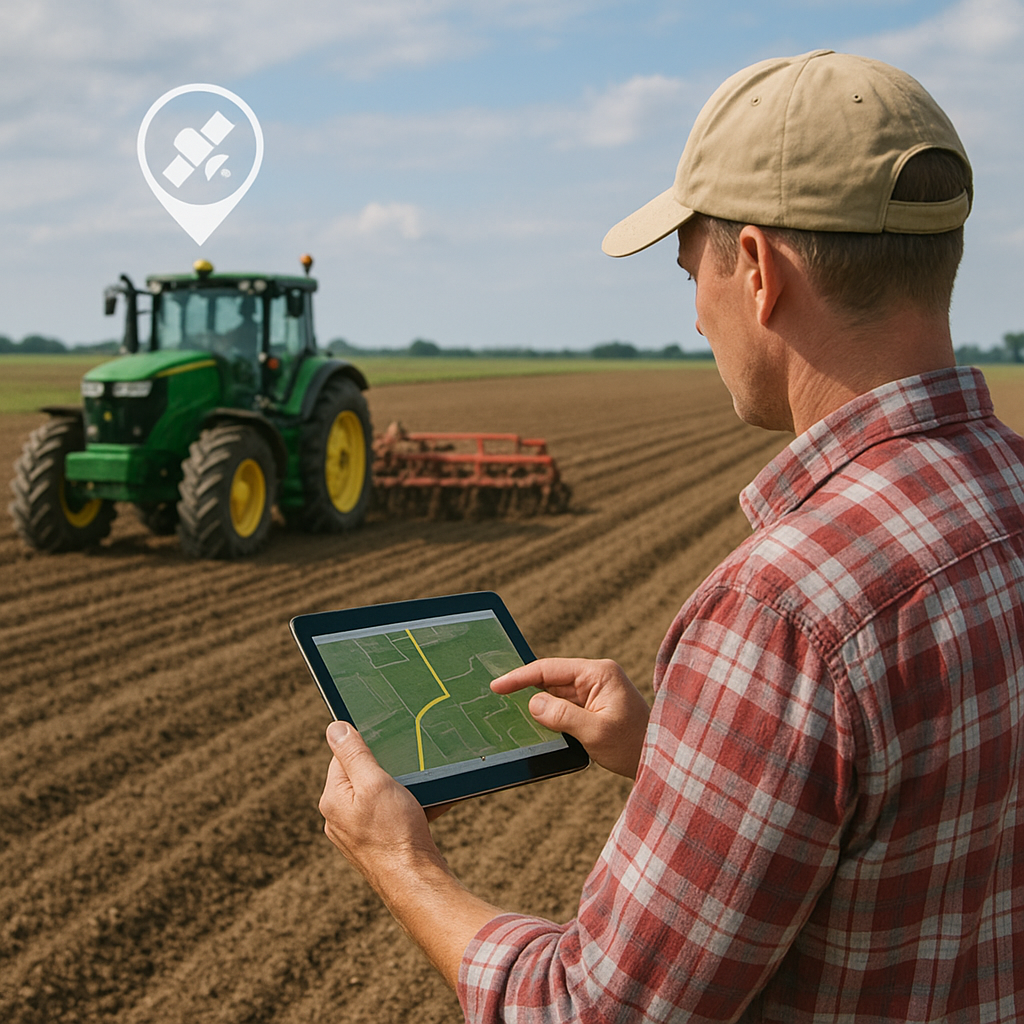
Implementing GPS receivers on farm machinery allows operators to navigate fields with remarkable accuracy. Tractors, combines, and sprayers equipped with guidance modules follow predefined routes within a few centimeters of error, thereby eliminating overlaps and gaps. Accurate mapping of field boundaries, obstacles, and irrigation channels is critical for planning and executing cultural operations.
- Auto-steer systems maintain straight passes even under low visibility conditions.
- Boundary mapping records natural features such as waterways, trees, and slopes.
- Section control technology shuts off sprayer booms at headland turns to prevent double application.
Such precise navigation not only improves operational consistency but also sets the stage for advanced analyses. Detailed field maps can be overlaid with soil surveys and yield data to reveal patterns that guide future strategies.
Enhanced Resource Management
Efficient use of inputs is at the core of sustainable production. Variable rate technology (VRT) marries GPS positioning with prescription maps, enabling on-the-go adjustments of seed, fertilizer, and chemical application rates. By targeting specific zones according to their unique needs, farmers can:
- Optimize nutrient distribution, reducing fertilizer waste and runoff.
- Adjust seeding density to match soil fertility and topography.
- Apply water precisely through GPS-guided irrigation systems.
These methods drive significant cost savings while supporting environmental sustainability. For instance, applying phosphorus only where the soil test indicates deficiency enhances overall efficiency and maintains long-term soil health.
Data-Driven Decision Making
Integrating real-time data from sensors, yield monitors, and weather stations with GPS coordinates empowers farmers with actionable insights. Sophisticated farm management software aggregates these inputs to generate detailed reports, facilitating informed decisions.
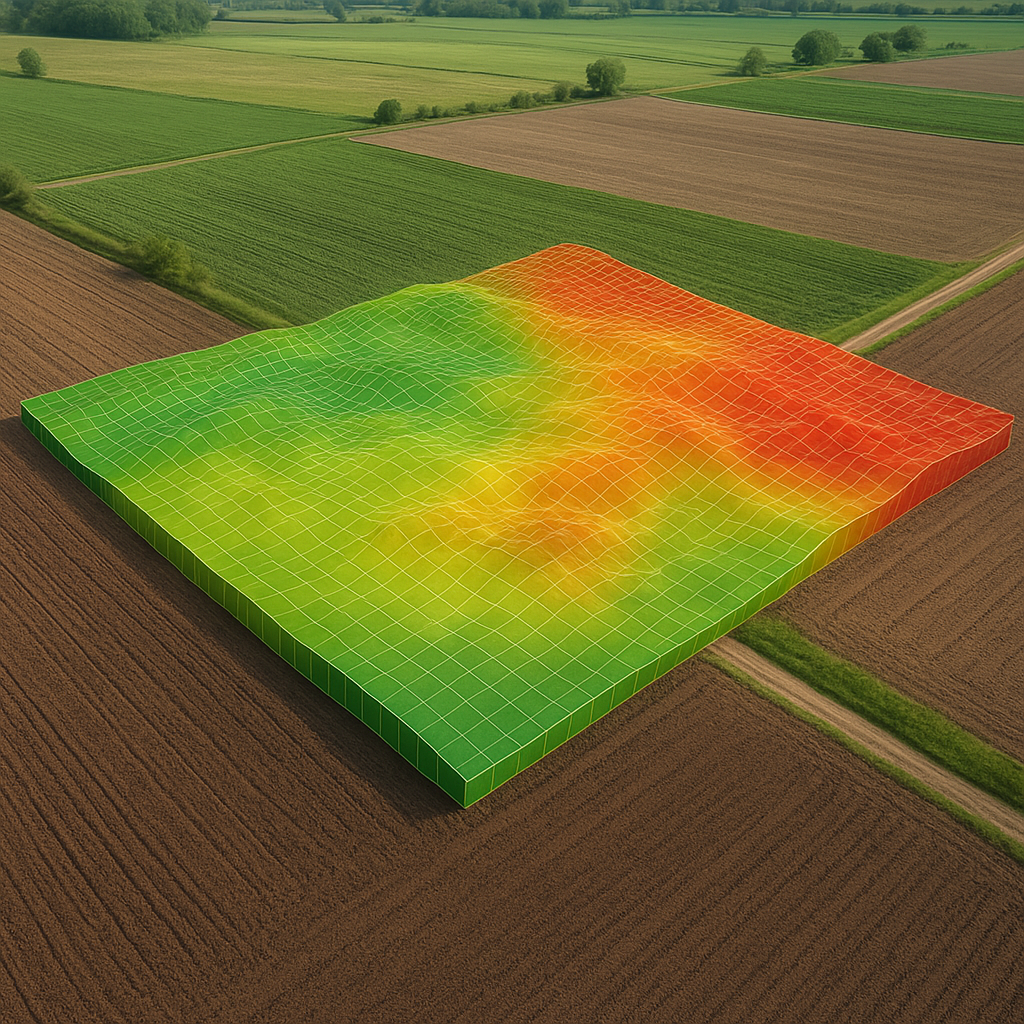
Yield Monitoring and Zone Management
Yield monitors mounted on combines record crop output and moisture content at precise locations. When combined with GPS, these measurements produce yield maps that highlight high and low productivity zones. Farmers can analyze:
- Spatial variability in crop performance over multiple seasons.
- Relationships between soil characteristics and yields.
- Effectiveness of previous management interventions.
Armed with this knowledge, growers refine their management zones for subsequent planting, creating tailored prescriptions that boost overall yield.
Real-Time Monitoring and Alerts
Remote sensing devices—such as soil moisture probes, weather stations, and drones—transmit data linked to GPS coordinates. This continuous stream of information supports:
- Early detection of plant stress, pest infestations, or disease outbreaks.
- Dynamic irrigation scheduling to prevent under- or over-watering.
- Automatic alerts to farm managers when critical thresholds are exceeded.
Proactive responses to anomalies reduce input waste, mitigate crop losses, and foster a system that adapts to changing conditions throughout the season.
Automation and the Path to Autonomous Farming
The synergy between guidance systems, sensors, and machine learning algorithms is driving the era of automation in agriculture. Unmanned tractors and self-steering implements handle repetitive tasks such as tillage and planting, freeing up labor and increasing on-farm efficiency. Key benefits include:
- 24/7 operation capabilities, maximizing field work during optimal weather windows.
- Reduced human error in critical passes, such as row crop alignment.
- Lower labor costs and enhanced safety by limiting exposure to equipment hazards.
Moreover, autonomous vehicles communicate their position and status through GPS-linked networks, seamlessly integrating with farm management platforms to coordinate multiple machines in large-scale operations.
Challenges and Future Perspectives
While the advantages of GPS-driven agriculture are substantial, certain challenges remain. Dependence on satellite signals can be affected by atmospheric conditions or signal obstructions. Ensuring reliable coverage requires investments in correction services such as RTK (Real-Time Kinematic) or SBAS (Satellite-Based Augmentation Systems). Additionally, data security and interoperability between devices from different manufacturers demand attention.
Future innovations are poised to overcome these hurdles. Enhanced satellite constellations promise higher signal accuracy and resilience. Edge computing on farm implements will reduce latency in decision-making, and emerging standards will facilitate seamless data exchange. The convergence of robotics, artificial intelligence, and geospatial technologies heralds a new paradigm where farms operate with minimal manual intervention, maximizing both economic returns and environmental stewardship.
Conclusion
Embracing satellite navigation and positioning technologies equips farmers with powerful tools to optimize every aspect of crop production. By harnessing precise mapping, resource management, data analytics, and automation, modern agriculture is achieving unprecedented levels of productivity and sustainability. The continued evolution of these systems heralds a future where smart farms deliver higher yield, lower environmental footprint, and resilient food systems for a growing global population.