The convergence of aviation and agronomy has given rise to a transformative practice: deploying unmanned aerial vehicles to sow seeds and seedlings across vast landscapes. By integrating precision flight patterns with advanced soil analysis, agriculturalists and environmentalists alike can boost reforestation efforts, optimize crop yields, and enhance overall land stewardship. This article explores the technology, applications, benefits, and future prospects of using drones to plant trees and crops.
Drone Technology in Modern Agriculture
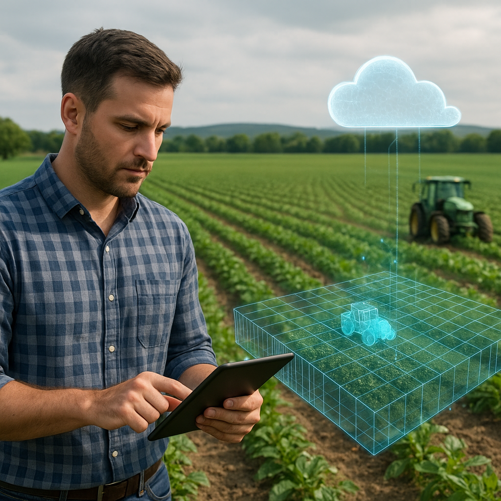
Recent advancements in drone hardware and software have revolutionized farm management. Fixed-wing and multicopter platforms now carry seed pods, nutrient capsules, and onboard sensors capable of capturing multispectral imagery. Remote sensing modules identify soil moisture, pH levels, and canopy health, sending real-time data to cloud servers for analysis. Flight controllers enable automated missions that follow GPS-guided waypoints, ensuring consistent coverage and minimizing overlap.
- Automation systems can launch, navigate, and land drones without direct human intervention.
- High‐resolution cameras and LiDAR scanners map terrain variations and detect erosion hotspots.
- Modular payload bays accommodate different seeding mechanisms, from pneumatic launchers to biodegradable pods.
Data analytics platforms integrate this aerial imagery with historical yield maps, allowing agronomists to plan drone missions that target underperforming fields or degraded forest areas requiring reforestation.
Planting Trees with Aerial Drones
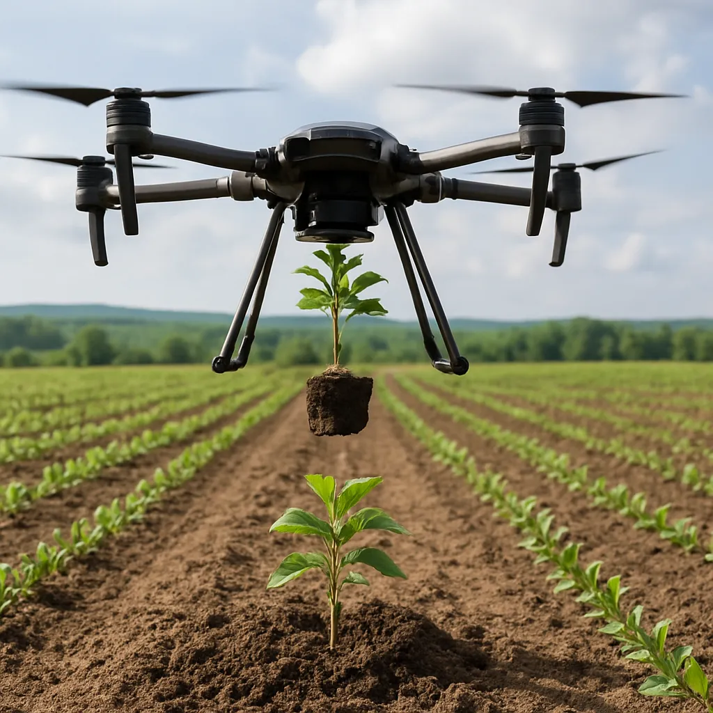
Large-scale reforestation, often hindered by rugged terrain and labor shortages, benefits enormously from drone interventions. Specialized seeders dispense pellets containing tree seeds coated in nutrients and growth stimulants. By programming flight grids over deforested or fire-scarred land, operators achieve a planting density previously unattainable by traditional hand-planting crews.
Key Steps in Aerial Tree Planting
- Site assessment using drone-derived topographic models to determine optimal seeding density.
- Seed preparation: mixing species appropriate for soil type and local climate, enhancing biodiversity.
- Flight mission planning: designing overlapping swaths to ensure uniform coverage.
- Monitoring: follow-up flights assess germination rates and identify areas needing supplemental planting.
Case studies demonstrate that drone‐based reforestation can achieve up to 10,000 seeds deployed per hectare in a single sortie, slashing labor costs and accelerating restoration timelines. When combined with ground crews that care for seedlings during critical establishment periods, this hybrid approach delivers sustainable forest ecosystems capable of long-term carbon sequestration.
Seeding Crops from the Sky
Beyond trees, drones are also seeding grains, legumes, and cover crops. Farms facing unpredictable weather windows can dispatch drones within hours to plant after heavy rains or before drought onset. Rapid response mitigates yield losses and maximizes farm productivity.
Advantages of Drone-Sown Crops
- Reduced soil compaction: aerial seeding eliminates the need for heavy tractors in wet conditions.
- Uniform emergence: precision drop mechanisms ensure seeds are spaced at optimal intervals.
- Cost-effective: lower fuel consumption and reduced labor translate to cost-effective planting operations.
Integrating drones with IoT weather stations and soil probes yields truly data-driven planting schedules. For instance, a network of sensors may trigger an aerial seeding mission the moment soil moisture reaches a predefined threshold, ensuring rapid germination and healthy crop stands.
Environmental and Economic Benefits
Deploying drones for planting fosters a synergy between ecological restoration and agricultural sustainability. Key benefits include:
- Enhanced sustainability: targeted planting reduces seed waste and conserves water through precise application of moisture-retaining coatings.
- Improved soil health: cover crops planted via drone intercept rainfall, reduce erosion, and fix atmospheric nitrogen.
- Budget optimization: with drones, smaller operational teams manage larger areas, driving down overhead expenses.
- Rapid response to emergencies: following wildfires or hurricanes, drone fleets can initiate large-scale reseeding to prevent invasive species encroachment.
Furthermore, drone mapping supports carbon credit schemes by providing verifiable documentation of tree density and growth rates. This opens avenues for farmers and land managers to monetize ecosystem services, creating new revenue streams while safeguarding natural resources.
Challenges and Future Directions
Despite the promise, several hurdles remain:
- Regulatory compliance: navigating airspace permissions, line-of-sight rules, and privacy concerns.
- Payload limitations: balancing drone weight capacity with flight endurance and coverage area.
- Seed survival: ensuring coated seeds withstand impact and germinate successfully in various soil conditions.
On the horizon, innovation is addressing these issues. Hybrid drones combining vertical takeoff with winged gliding promise extended range and heavier payloads. AI-driven flight planners will adapt missions mid-flight based on live sensor feeds, optimizing droplet counts and release patterns. Collaborative drone swarms could blanket thousands of hectares in a fraction of the time required by solo systems.
In addition, research into biodegradable delivery mechanisms and symbiotic microbial coatings aims to further boost seedling survival and soil regeneration. As drone costs decline and operational expertise grows, aerial planting will become an indispensable tool in the quest for global food security and ecological resilience.